This is another in our series of continuing retrospective adventures “Travels With Dan.” To California, the Golden State . . . and golden it is. This trip was 29 years ago and though I have traveled much since then, there really is no comparable place in terms of variety of geography, geology, and biology. This trip was really outstanding, but I’m glad I did it when I was a fine strapping young buck of 40 – we did some pretty serious hiking. This trip included San Francisco, Muir Woods, Redwoods, Yosemite, Tuolumne Meadows, Mono Lake, Sequoias/Kings Canyon, and Mineral King. And that still left for subsequent trips such as to the desert, Death Valley, Salton Sea, Joshue Tree, south coast beaches and coast highway, the wine country . . . the state just has everything including, of course, too many people and too much traffic.
This video has been watched almost 150,000,000 times on YouTube:
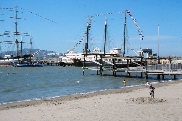
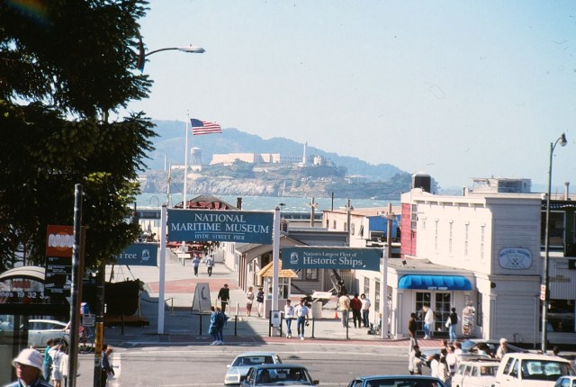
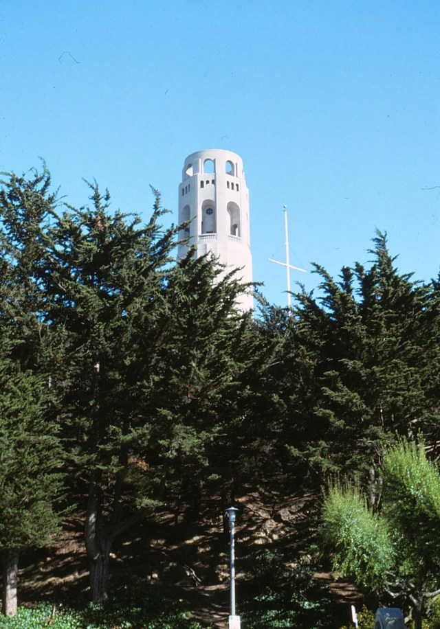
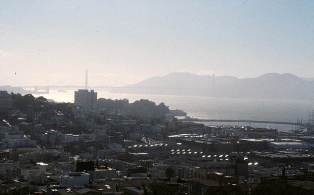
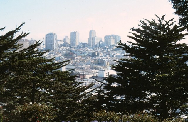
San Francisco
[These kids are in their 30’s now . . . ]

[Ahhhh, chocolate! And be sure to wear some flowers in your hair.]

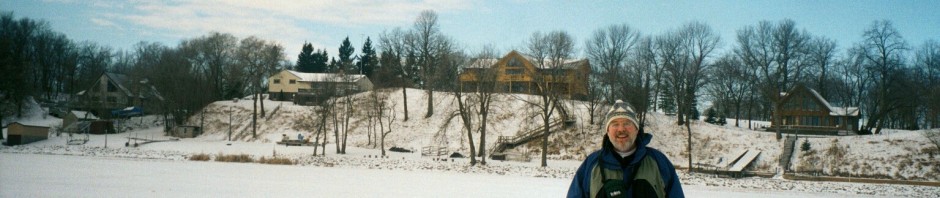
[And here’s my tour guide, wearing yellow so he doesn’t get lost in the crowd.]

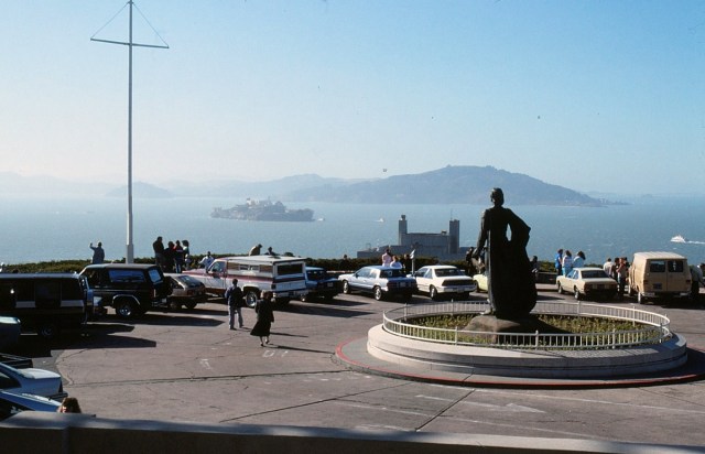
[Coit Tower, also known as the Lillian Coit Memorial Tower, is a 210-foot tower in the Telegraph Hill neighborhood. The tower, in the city’s Pioneer Park, was built in 1933 using Lillie Hitchcock Coit’s bequest to beautify the city of San Francisco; at her death in 1929 Coit left one-third of her estate to the city for civic beautification. The tower was proposed in 1931 as an appropriate use of Coit’s gift. It was added to the National Register of Historic Places on January 29, 2008. (Wikipedia)]
[We honored the Golden Gate Bridge in a previous post; here’s the Bay Bridge connecting San Francisco and Oakland.]

[And here’s a hazed out Golden Gate.]
[The statue of Christopher Columbus (not Gaspar de Portolà, the first European to discovered San Francisco Bay on November 4, 1769?) at Coit Tower overlooking Alcatraz Island.]
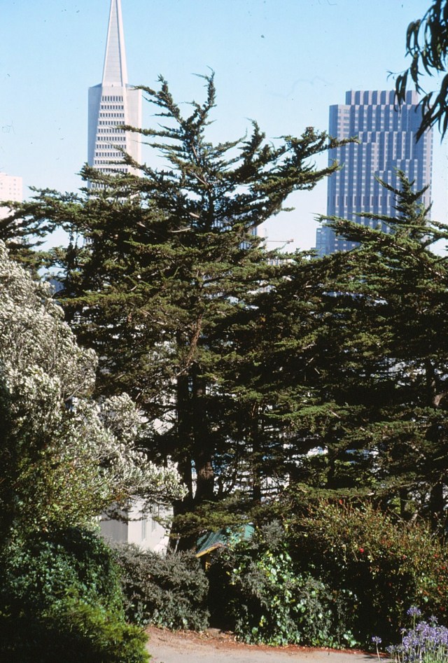
[And the still famous Transamerica Pyramid.]
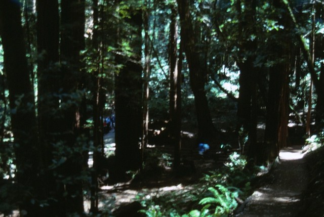
Muir Woods
[One of those places that upon first entrance you will never forget. A glorious assault on the visual and nasal senses!]
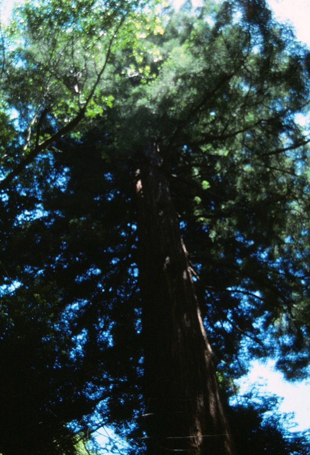
[If you’ve ever tried, you know it’s impossible to take photos in a forest – it’s like you can’t see the trees for the forest (or is it the forest for the trees?).]


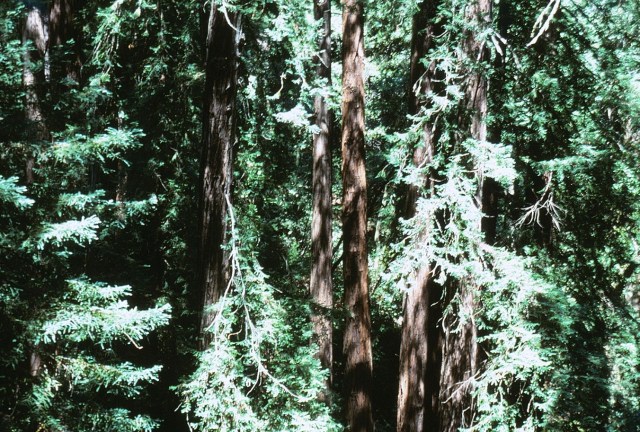
[Can you smell the Redwoods?]
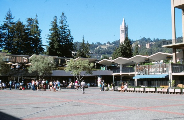
Berkeley
[Uffda, not a single counter-culture person in sight?]
Yosemite
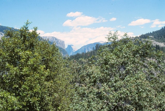
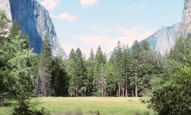
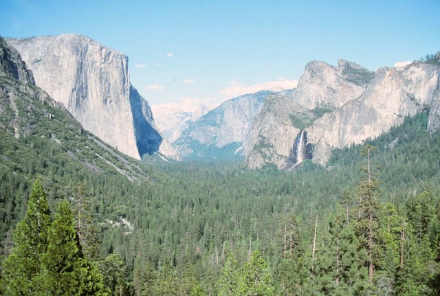
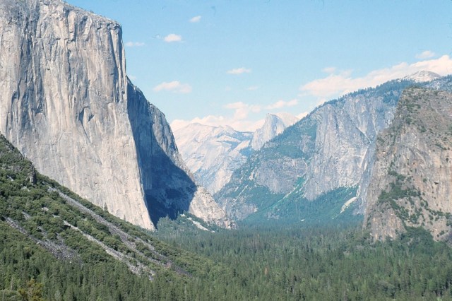
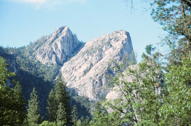
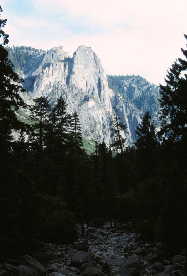
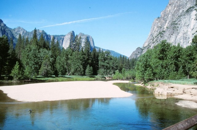
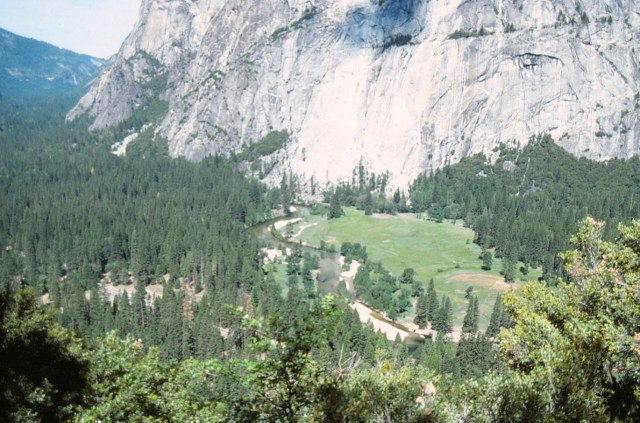
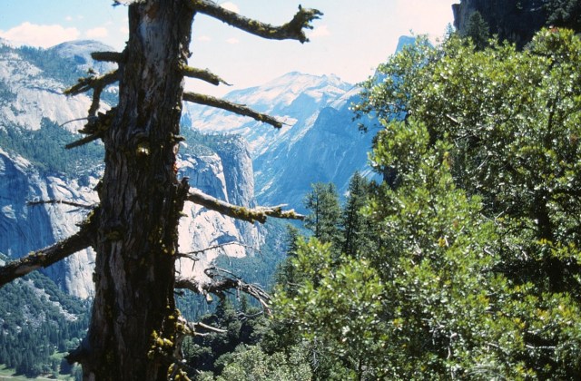
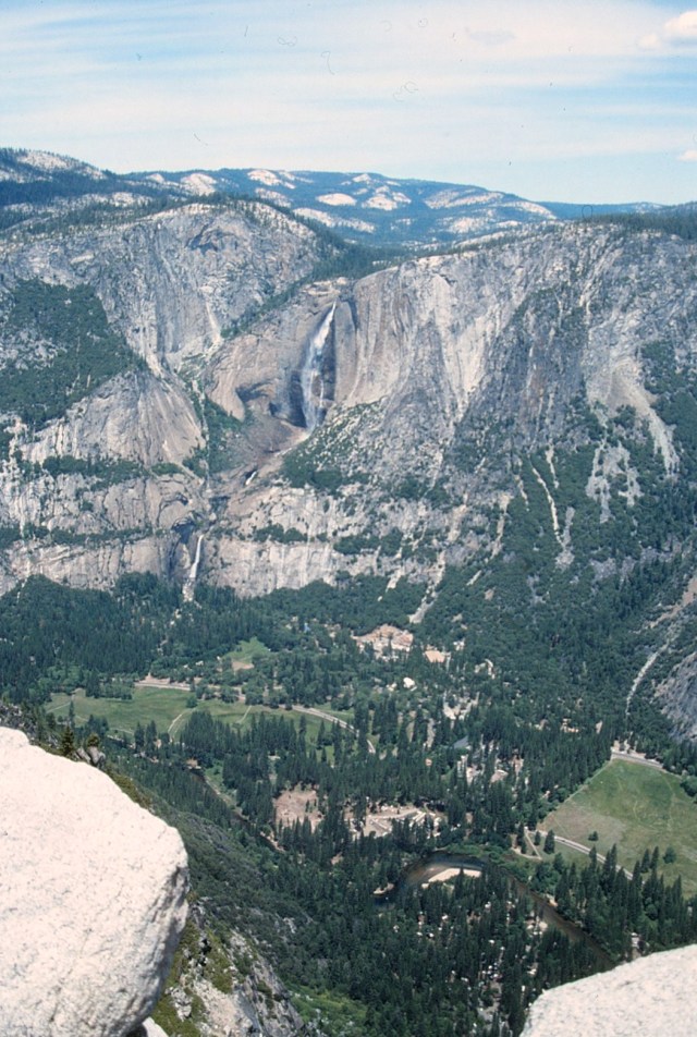
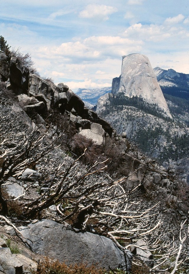
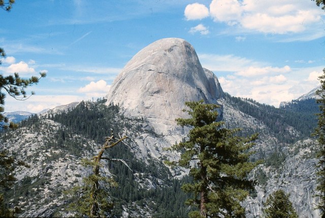
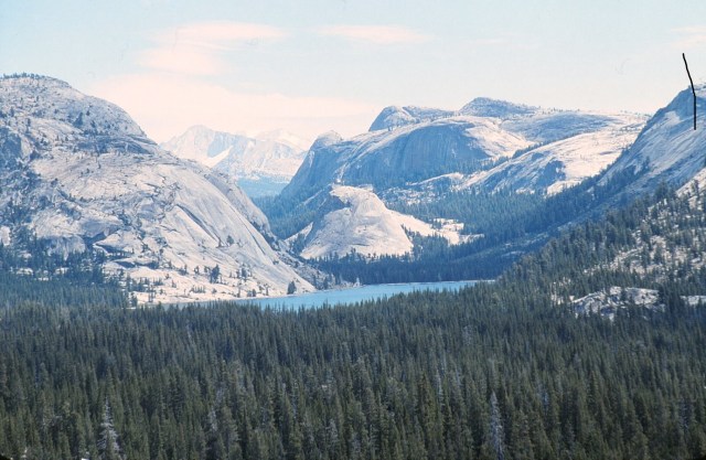
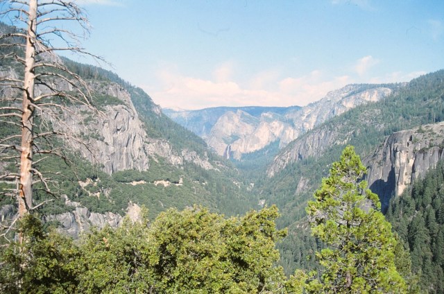
[Yosemite Valley, another assault on all senses. We sure timed our visit right – the place is now so incrediby popular, I believe you may have to make reservations just for a visit and cars are no longer allowed in the park. Why, yes, that is Half Dome in the distance.]

[What a front door . . . ]

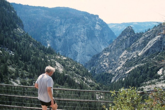
[A long drop into the valley.]

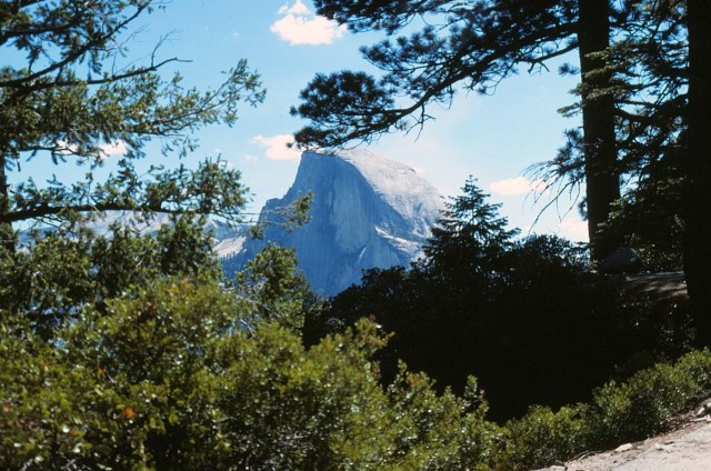
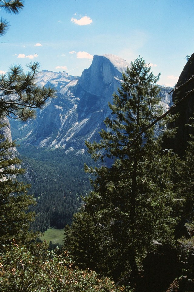
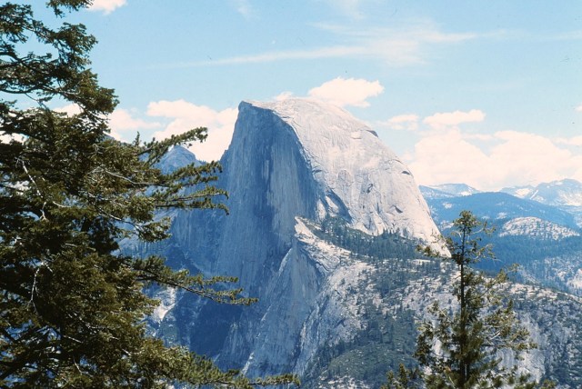
[Half Dome is a granite dome at the eastern end of Yosemite Valley in Yosemite National Park. It is a well-known rock formation in the park, named for its distinct shape. One side is a sheer face while the other three sides are smooth and round, making it appear like a dome cut in half. The granite crest rises more than 4,737 ft (1,444 m) above the valley floor. (Wikipedia)]

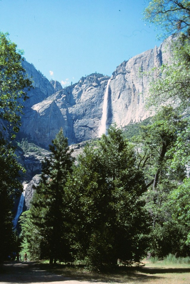
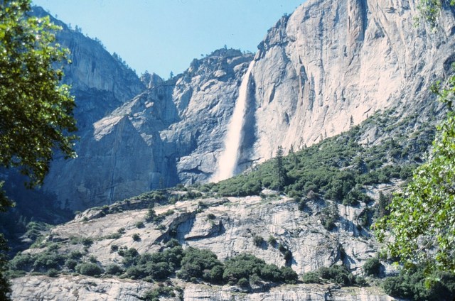
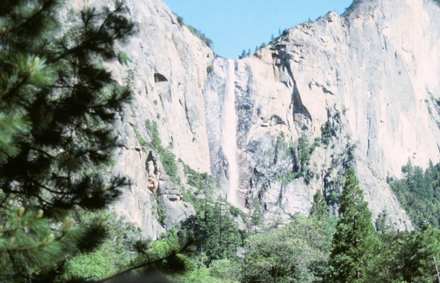
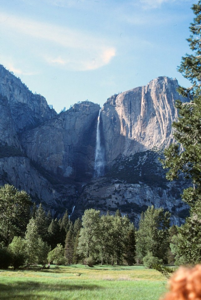
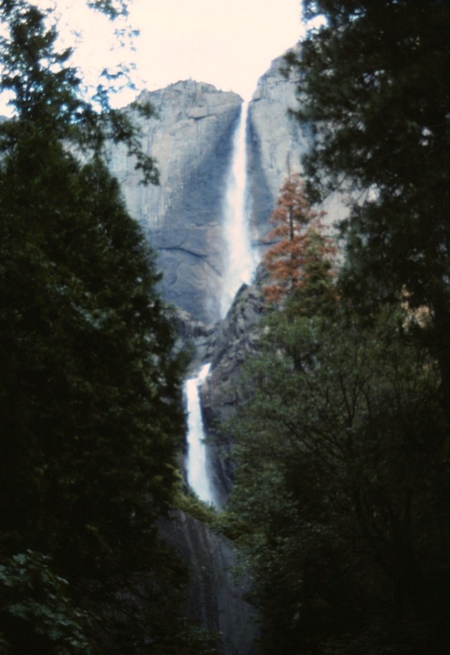
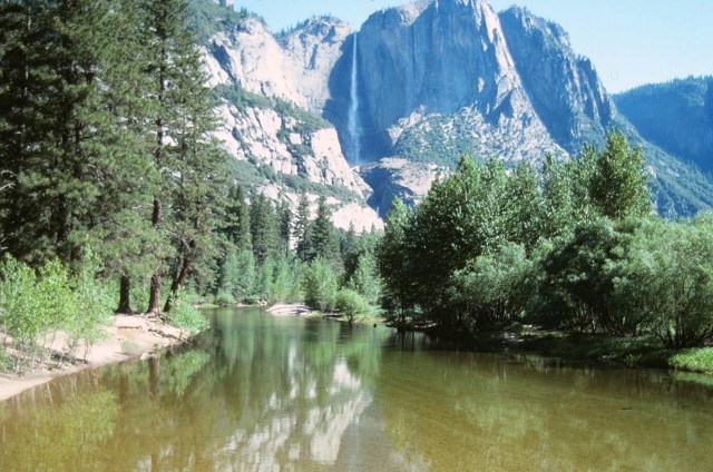
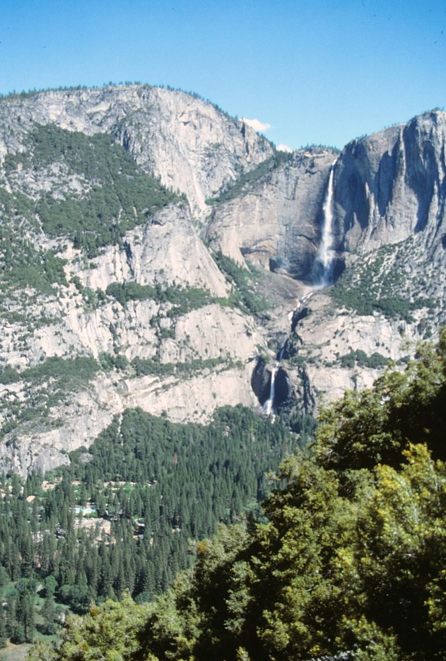
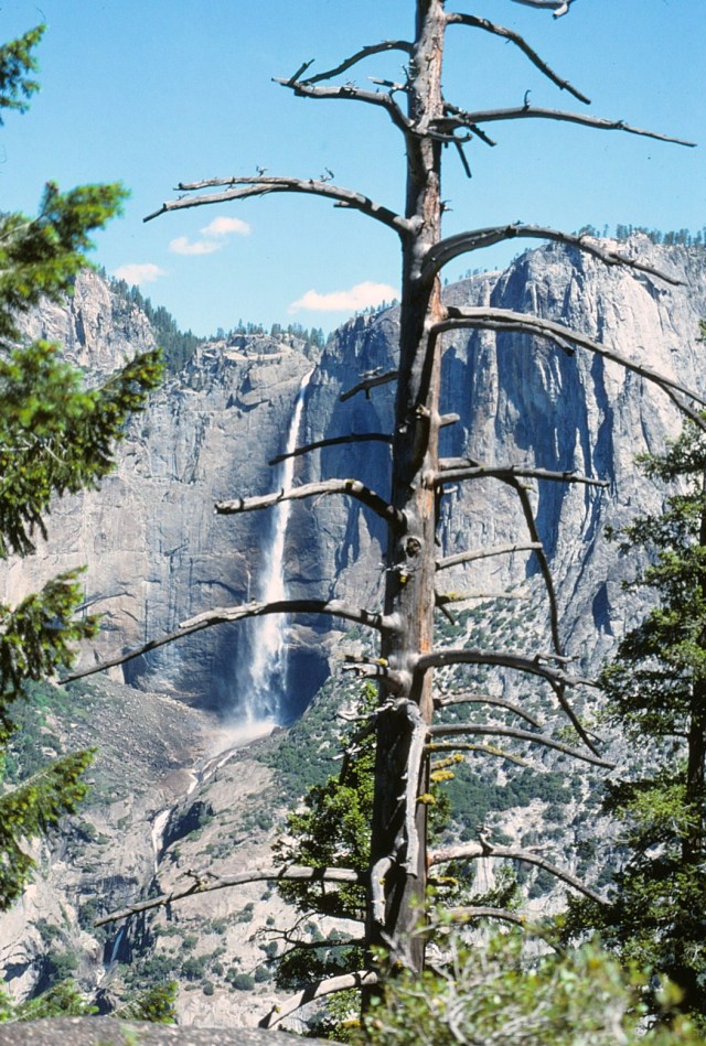
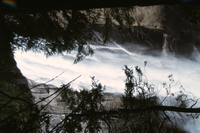
[Yosemite Falls is the highest waterfall in the park, dropping a total of 2,425 feet (739 m) from the top of the upper fall to the base of the lower fall. (Wikipedia)]
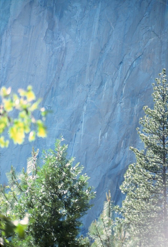
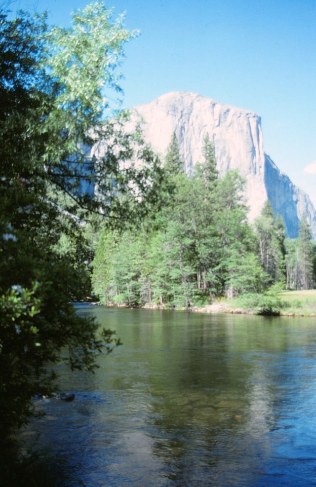
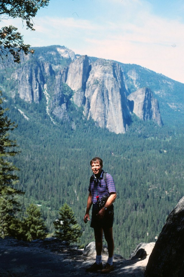
[El Capitan (Spanish for The Captain, The Chief) is a vertical rock formation, located on the north side of Yosemite Valley, near its western end. The granite monolith extends about 3,000 feet (900 m) from base to summit along its tallest face and is one of the world’s favorite challenges for rock climbers and BASE jumpers. (Wikipedia)]

[Climbers (can you see them?) . . . sheer madness!!]
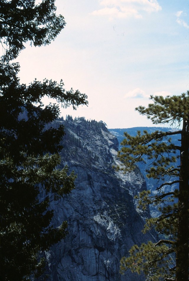
[The valley . . . ]
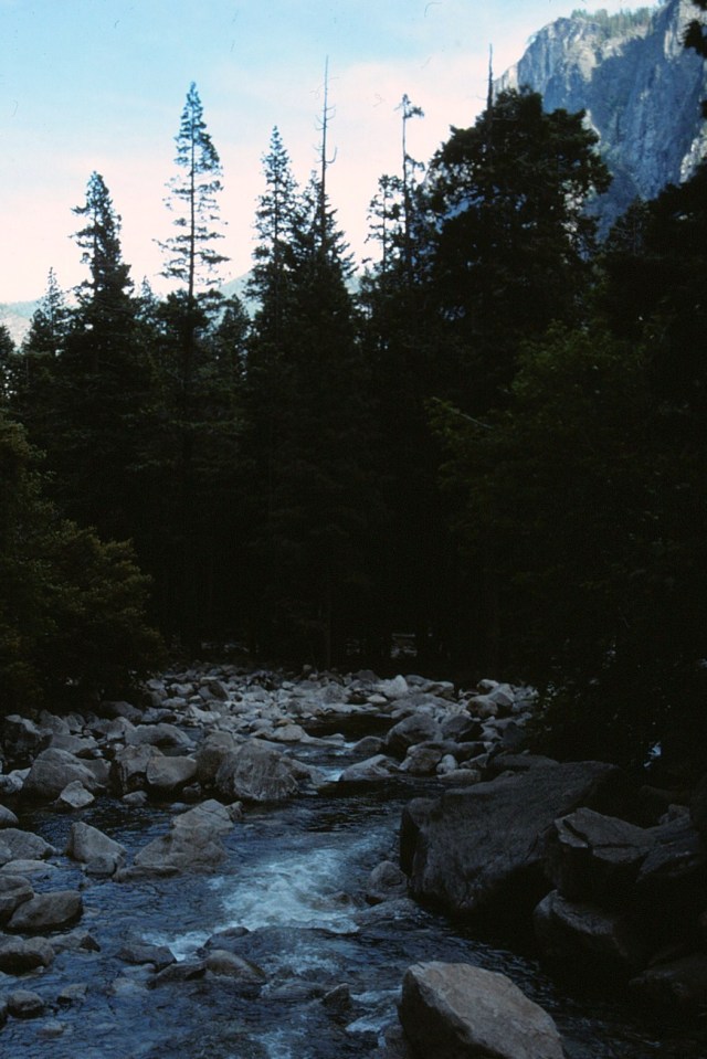
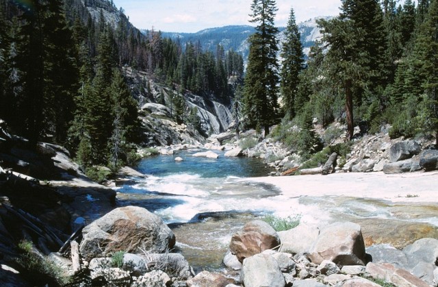
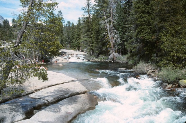
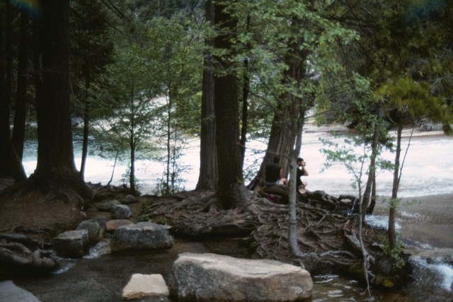
[Merced River . . . ]
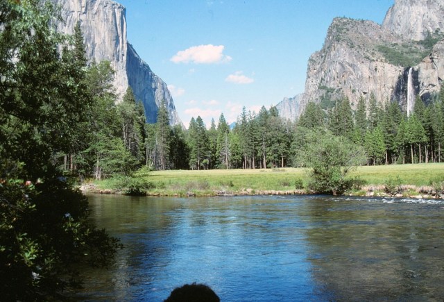
[The Merced with an out-of-focus(?) El Capitan . . . ]
[Kinda shouts Yosemite, eh?]
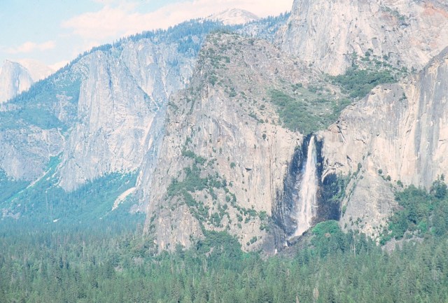
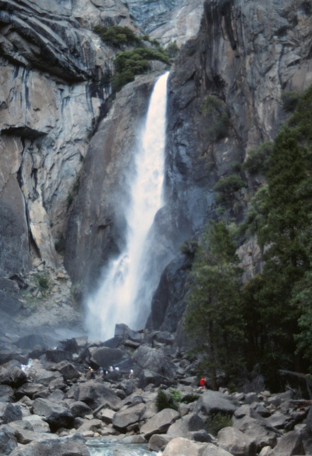
[I suspect this may be Bridalveil Falls.]
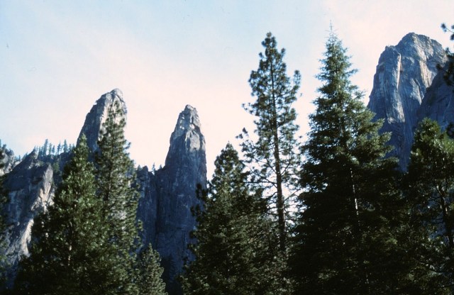
[Twin Peaks?]

[Yosemite Falls]
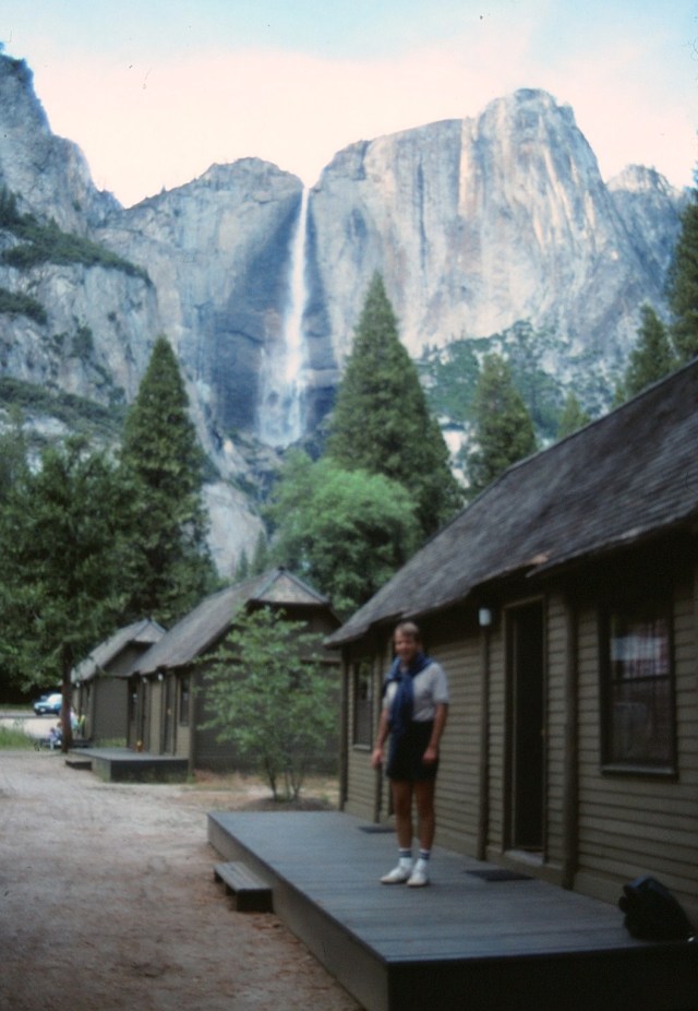
[And an out-of-focus camper. Yes, we stayed in this cabin . . . now I think you need to make reservations about a hundred years in advance to get one.]
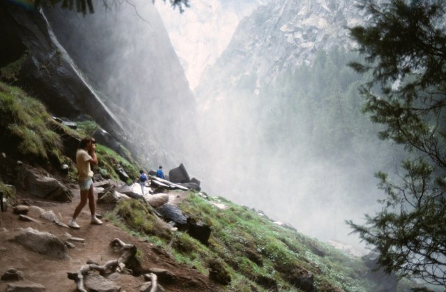
[So close to the falls . . . ]
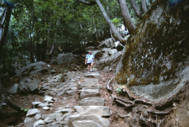
[Walking around the valley floor . . . ]
[Let’s get wet!!]
[On a beautiful day, just beautiful . . . ]
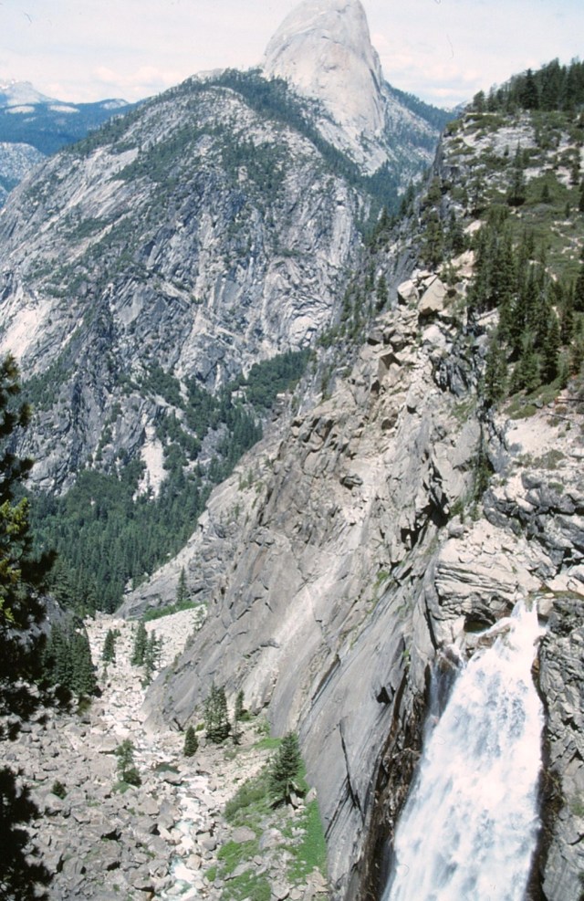
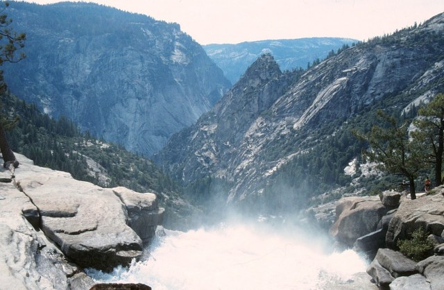
[Here we go! Panorama Trail 8.5 miles/13.7 km one-way to Valley floor (via Mist Trail); 6 hours for 3,200 ft/975 m descent. Begin at the Panorama Trailhead, Glacier Point. As its name implies, this trail offers some incredible panoramic views of Yosemite Valley. The trail crosses Illilouette Fall after 2 miles (3.2 km) and continues partially uphill along the Panorama Cliff. At the top of Nevada Fall, the trail joins the Mist and John Muir Trails to Happy Isles. (www.nps.gov)]
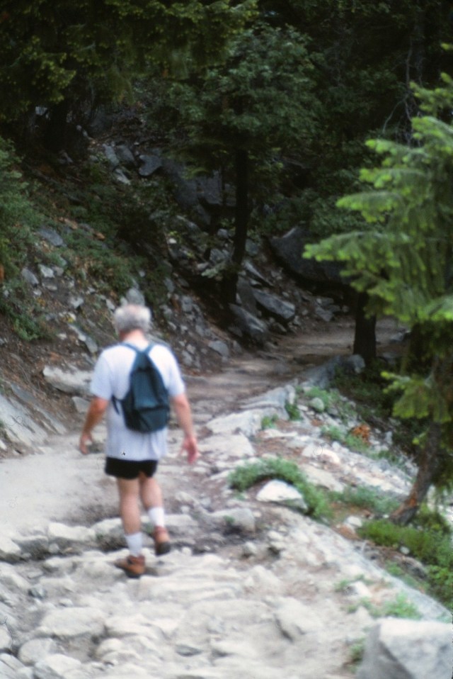
[I don’t remember for sure if it was the Panorama Trail, though it looks like it. We obviously didn’t take it all the way to the top of Half Dome (12 – 14 hours round trip), but it was a long hike with, as you can see, big elevation. We were pretty elevated when I took this shot of Yosemite Falls.]
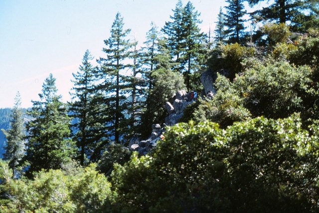
[Other folks on the trail ahead of us . . . ]
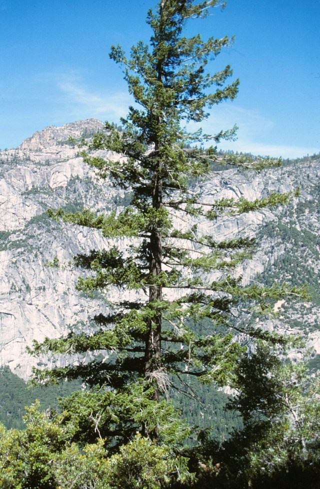
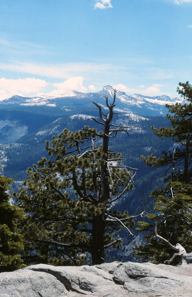
[Cool tree]
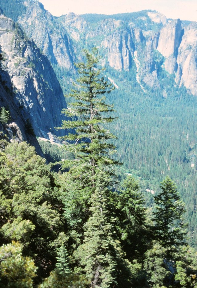
[Cool tree, different angle . . . ]
[Is this a rugged trail hiker . . . or Mr. Whipple?]
[Bald tree]
[Oy, that’s a long way down . . . how’d I get up here?]
[We’re coming around Half Dome’s left flank . . . ]
[Farther along, we seem to be a mile off the valley floor (yea, that’s where we started from)!]
[Water break, or does he have some sort of secret energy drink there?]

[Ever closer . . . ]
[Now we’re above the falls . . . without a pilot’s license!!]
[Sneaking around to the back side.]

[I may need oxygen.]
[There does come a time when you wonder, “How are we going to get back down?”]
[If I had known this is where we were going, I’d likely have queried, “Are you nuts?”]
[Can a helicopter pick us up from here?]
[No, we’re not back down in the valley yet, this is just your basic high alpine mountain top.]
[We’re still we up here . . . ]
[To the point we’re in Half Dome’s backyard.]
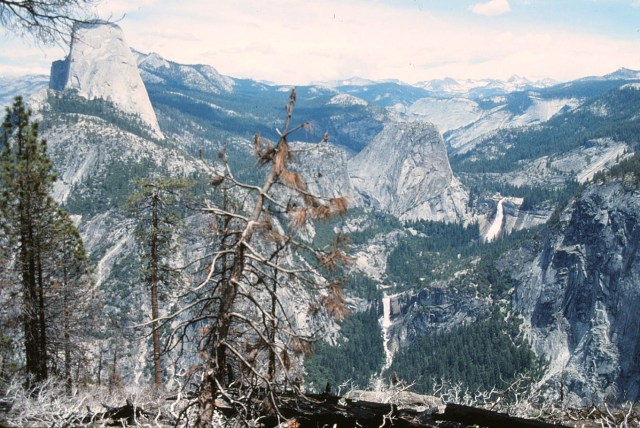
[Maybe Illilouette Falls from above . . . ]
[At long last, starting back down . . . ]
[I can’t believe I took this picture without extreme vertigo setting in?]
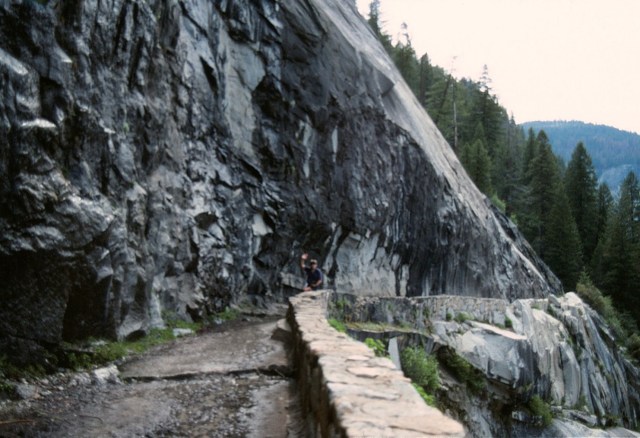
[Finally, a trail with a retaining wall so I won’t fall over the edge . . . ]
[Nope, not going up there . . . ]
[Grizzled wilderness hikers now . . . ]

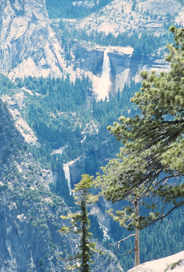
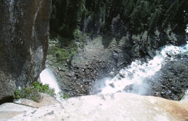
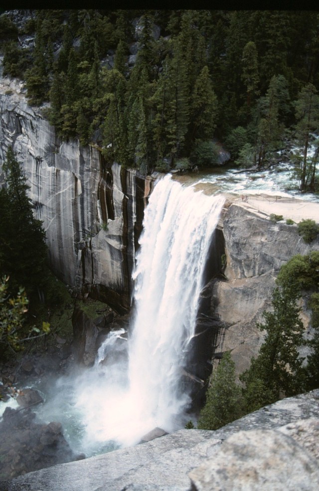
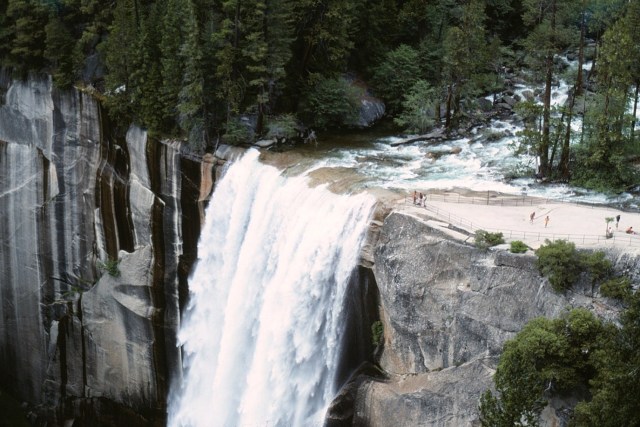
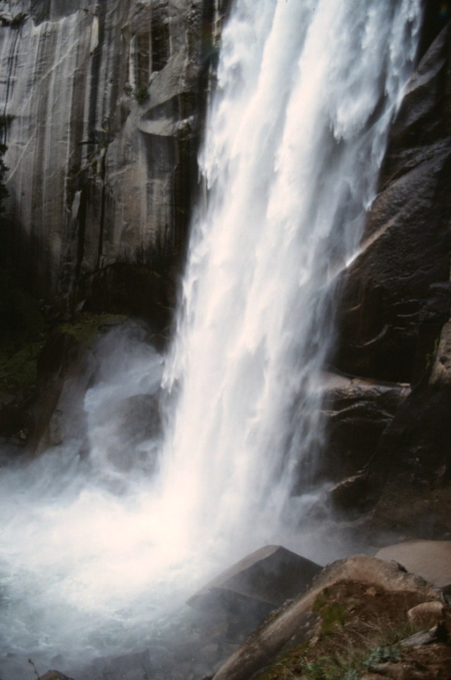
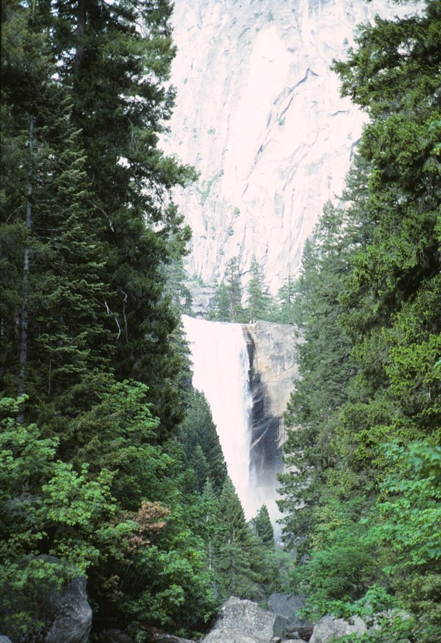
[Likely Vernal Falls . . . ]
[I’d like to buy a safer trail?]

[Watch your step!]
[In the mist of the falls.]
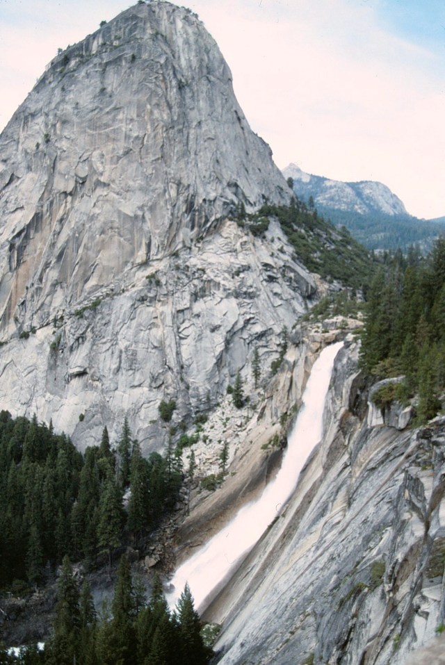
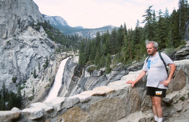
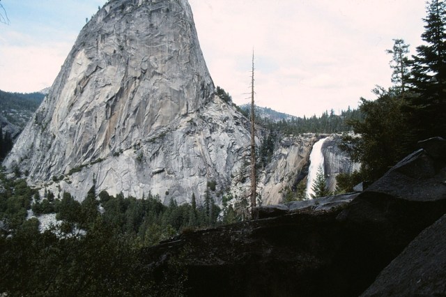
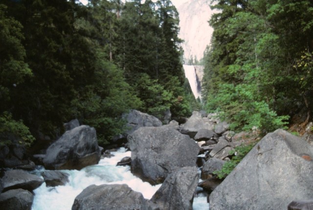
[This quite likely is on the Mist Trail with Nevada Falls . . . ]
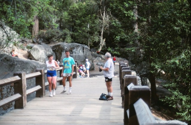
[Back amongst humanity . . . ]
[Time to go to the eastern side of the park . . . ]
Mono Lake
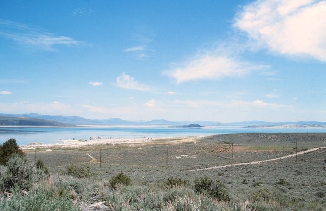
[Where we picked up Mono Lake: a large, shallow saline soda lake in Mono County, formed at least 760,000 years ago as a terminal lake in an endorheic basin. The lack of an outlet causes high levels of salts to accumulate in the lake. These salts also make the lake water alkaline. This desert lake has an unusually productive ecosystem based on brine shrimp that thrive in its waters, and provides critical nesting habitat for two million annual migratory birds that feed on the shrimp and blackflies (that also feed on the shrimp). When the city of Los Angeles diverted water from the lake, it lowered the lake level, which imperiled the migratory birds. The Mono Lake Committee formed in response and won a legal battle that forced Los Angeles to partially replenish the lake level. (Wikipedia) The water battles were going on when we were there – the lake level was really low.]
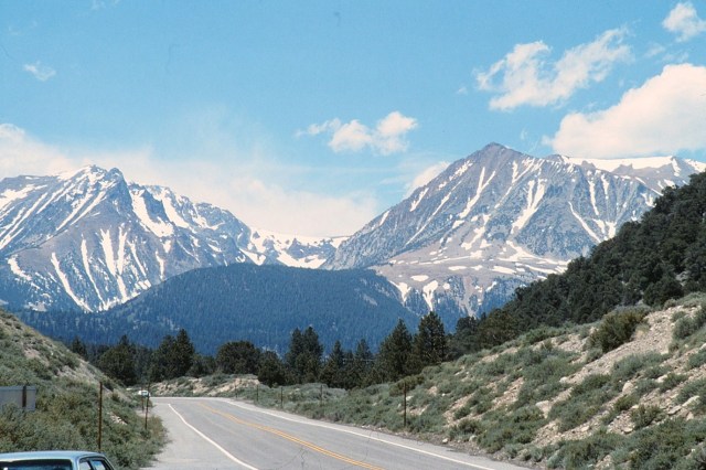
[On the road again . . . ]
[We are now hiking through . . . ]

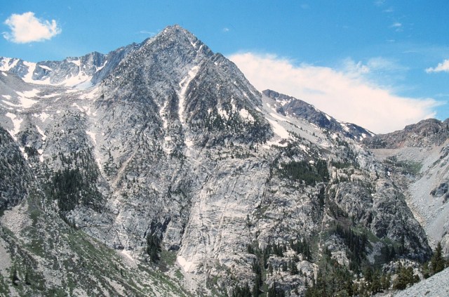
[Tuolumne Meadows is a gentle, dome-studded sub-alpine meadowy section of the Tuloumne River, in the eastern section of Yosemite National Park. Its approximate elevation is 8,619 feet (2,627 m). The term Tuolumne Meadows is also often used to describe large portion of Yosemite high country around the meadows, especially in context of rock climbing. (Wikipedia)]

[This was quite lovely and peaceful at almost 9,000 feet into the sky . . . ]
[Who knows how many miles we’ve covered today?]


[I was never a bandana wearer? Can you be dressed like a total yuppie and still be following in the trail of Grizzly Adams (OK, John Muir)?]

[And Dan marches on . . . ]


[One of those places on the planet where every step is a photo op.]
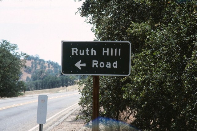
Fresno
[Done with the day’s hiking, looking for a meal and lodging. I first met the Supervisor in the fall of 1987, so this was likely less than a year later. Her name at the time was Ruth Hill. And it was going into Fresno where we were stopped in a generic drunk driver road block. It was dark, the trooper shined a light in my eyes and asked how much I’d had to drink. I said none. He persisted (I think my eyes were contact lens bloodshot after being out in the sun all day). I was tired and grumpy, told him in a strong tone of voice we’d been hiking all day and now we were looking for a place to get drinks! So, there!]
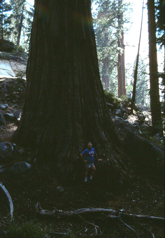
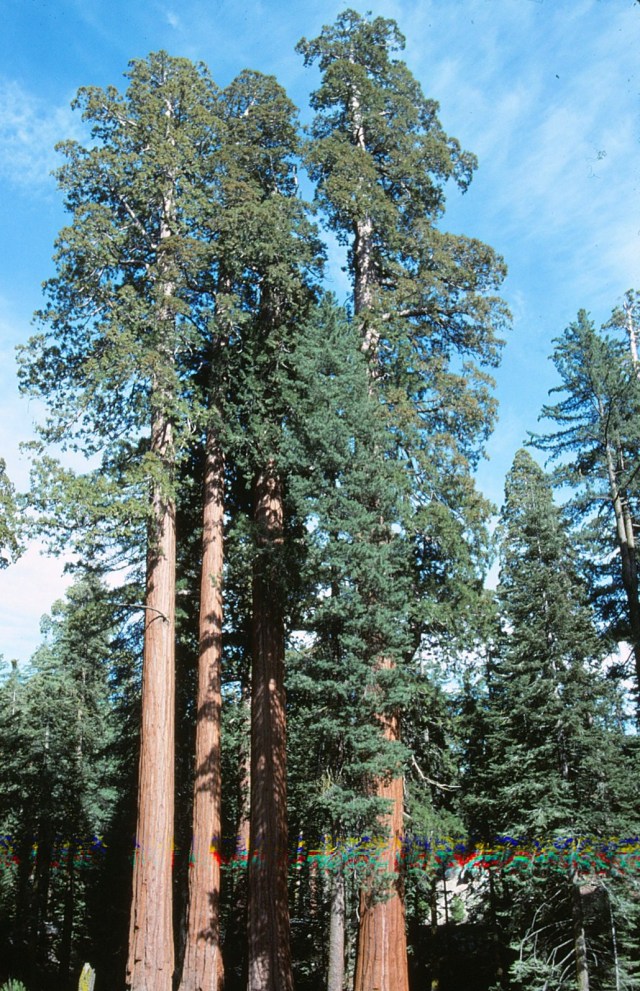
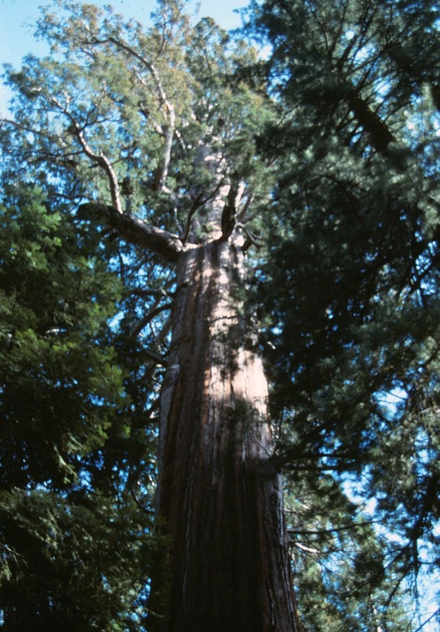
Sequoias
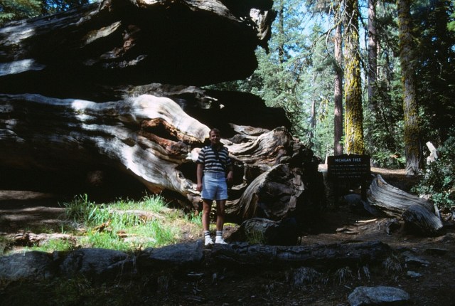
[Kings Canyon National Park is a national park in the southern Sierra Nevada, east of Fresno. The park was established in 1940 and covers 461,901 acres (721.720 sq mi; 186,925 ha; 1,869.25 km2). It incorporated General Grant National Park, established in 1890 to protect the General Grant Grove of giant sequoias. The park is north of and contiguous with Sequoia National Park; the two are administered by the National Park Service jointly as the Sequoia and Kings Canyon National Parks. They were designated the UNESCO Sequoia-Kings Canyon Biosphere Reserve in 1976. (Wikipedia)]
[This is in the Grant Grove loop. The “Michigan Tree” fell in 1931 because there was a spring under it.]
[The common use of the name sequoia generally refers to Sequoiadendron giganteum, which occurs naturally only in groves on the western slopes of the Sierra Nevada Mountains. Giant sequoias are the world’s largest single trees and largest living thing by volume. They grow to an average height of 50–85 m (164–279 ft) and 6–8 m (20–26 ft) in diameter. Record trees have been measured to be 94.8 m (311 ft) in height. The widest known at chest height is 8.2 m (27 ft). Between 2014 and 2016, specimens of coast redwood were found to have larger trunk diameters than all known giant sequoias. The oldest known giant sequoia based on ring county is 3,500 years old. Giant Sequoias are among the oldest living things on Earth. (Wikipedia)]
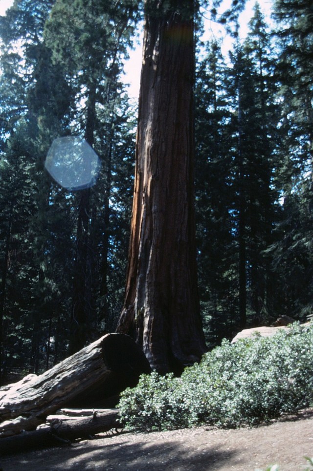
[“Awesome” just can’t quite properly express it!]
I love California, I practically grew up in Phoenix. ~ Dan Quayle
Up Next: Part 2

I don’t even remember being invited!